
Ten roofless stone houses survive with their built-in furniture still in place — hearths, dressers, box-beds — occupied for roughly six hundred years from about 3180 BC, making this one of the most complete Neolithic villages known in Europe.
Ten stone houses stand roofless at Skara Brae, fitted still with the furniture their occupants built into the walls and floor: a hearth at the centre of each room, a stone dresser raised opposite the low slab-doored entrance, and box-beds set into either side — the larger to the right, the smaller to the left. No timber survives on this treeless coast, so everything that remains is worked flagstone: dressers, beds, drains, storage boxes, all carved rather than built from anything that could rot away.
The settlement sits on the Bay of Skaill, on the west coast of Mainland Orkney, occupied for roughly six hundred years from about 3180 BC.
What we know
A storm in the winter of 1850 stripped turf from a coastal knoll at Skaill and exposed the outline of a buried village. William Graham Watt, son of the local laird at Skaill House, began an amateur dig soon after, uncovering four houses before work stopped in 1868. The site was plundered by a party with shovels over a single weekend in 1913, and a storm in 1924 swept away part of a house — prompting a proper excavation under Professor V. Gordon Childe of the University of Edinburgh from 1927. Photographs from that dig were long thought to show tourists standing nearby; in 2019 four of the women in them — Margaret Simpson, Margaret Mitchell, Mary Kennedy and Margaret Cole — were re-identified as Childe’s own students, active participants in the work. Excavation resumed in 1972–73, reaching waterlogged layers below the houses that preserved organic material lost everywhere else on the site.
Radiocarbon dating places occupation from about 3180 BC to around 2500 BC, making Skara Brae one of the most complete Neolithic villages known in Europe. The community here made and used grooved ware, a pottery style newly arrived in northern Scotland, and kept cattle, pigs and sheep; 1972 excavations showed they also grew barley, alongside a diet thick with fish and shellfish drawn from the midden that still surrounds the houses. Spiral carving on stone balls found here, and ivory pins resembling those from the Boyne Valley passage graves, point to some cultural contact with Neolithic Ireland — though the nature of that contact is not established. Around 2500 BC, as the climate turned colder and wetter, the village was abandoned for reasons still unknown; its burial under sand was gradual, not the single catastrophic storm popular accounts often describe.
What is said
The archaeologist Euan MacKie once suggested the settlement may have housed a privileged class of astronomer-priests who carried out ceremonies at the nearby Ring of Brodgar and Standing Stones of Stenness — a claim later scholars regard as unsupported by the archaeology. Symbols carved into some stone lintels and bed posts have sometimes been said to show “runic writings”, though the translations offered for them remain contested.
What to see now
Ten structures and four passageways remain visible, connected underground by low, narrow, slab-roofed corridors that could be closed off with a fitted stone door. Each house follows a near-identical plan: hearth at the centre, dresser against the far wall, beds to either side. House 8 stands apart from the pattern — a free-standing structure with walls over two metres thick and a porch, without dressers or storage boxes, thought to have served as a workshop rather than a dwelling. Clay-sealed stone boxes, watertight and possibly used to keep bait, sit built into several floors, and stone drains run beneath at least five of the houses.
How to visit
Skara Brae is at Sandwick, Orkney, KW16 3LR — National Grid reference HY 231 188 — in the care of Historic Environment Scotland, part of the “Heart of Neolithic Orkney” World Heritage Site. The official visitor centre car park sits about 395 metres from the site, roughly five minutes along a path beside the shore; there is no space there for large campervans, so HES asks that drivers phone ahead to check space in the beach car park. Entry was free at the time these sources were checked, though opening times vary seasonally and should be confirmed with Historic Environment Scotland before travelling. A 2019 risk assessment by HES and partners found the site “extremely vulnerable” to climate change, warning that a single severe storm could damage it further.
What follows is drawn from published sources, with each claim labelled by how firmly it is established.
The name
The name Skara Brae reflects Orkney's layered linguistic history. 'Brae' is a Scots word for a slope or hillside; 'Skara' derives from earlier recorded forms such as Skerrabra or Styerrabrae, names originally applied to the grassy mound that covered the buried settlement — reflecting the strong Scandinavian influence on Orkney place-names after Norse settlement. The name therefore originally described the natural knoll that concealed the village, not the Neolithic settlement itself, whose builders' own name for it is unknown.
History
Skara Brae is a stone-built Neolithic settlement on the Bay of Skaill, Mainland, Orkney. Radiocarbon dating places its occupation from about 3180 BC, continuing for roughly six hundred years until around 2500 BC, making it Europe's most complete Neolithic village.
Around 2500 BC, after the climate became colder and wetter, the settlement was abandoned; the cause is unknown. Its burial in sand was gradual, contrary to popular accounts of a single catastrophic storm.
It was inscribed as part of the 'Heart of Neolithic Orkney' UNESCO World Heritage Site in December 1999. A 2019 risk assessment by Historic Environment Scotland and partners found the site 'extremely vulnerable' to climate change, warning it could be partially destroyed by a single severe storm.
People
-
William Graham Watt
Son of the local laird (Skaill House) and self-taught geologist who began amateur excavation after the 1850 storm, uncovering four houses before work was abandoned in 1868
-
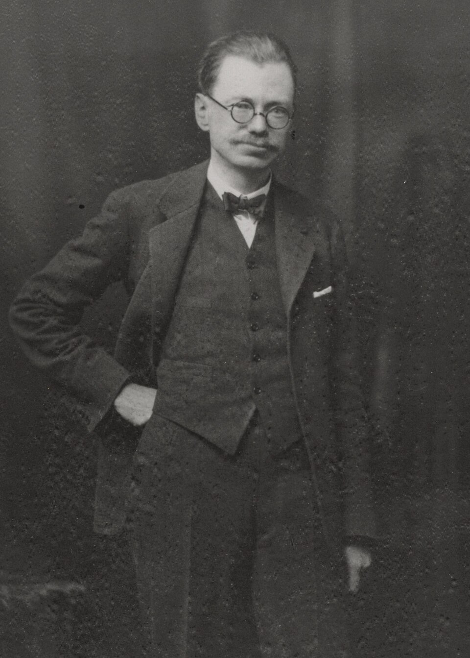
Portrait: Swan Watson, Andrew / Wikimedia Commons / Public domain V. Gordon Childe
University of Edinburgh professor who led the scientific excavation from 1927
-
Margaret Simpson, Margaret Mitchell, Mary Kennedy and Margaret Cole
Childe's students, re-identified in 2019 as active participants in the excavation (long mistaken for tourists)
-
The Grooved Ware People
The Neolithic pastoralist community that built and occupied the settlement
Cultural influences
-
Grooved ware culture — the inhabitants made and used grooved ware, a distinctive pottery style that had recently appeared in northern Scotland.
-
A pastoral, partly farming economy — the people raised cattle, pigs and sheep, ate seafood (fish bones and shells fill the midden), and 1972 excavations showed barley was cultivated.
-
Cultural links with Ireland — spiral ornamentation on the site's carved stone balls, and ivory pins similar to those from passage graves in the Boyne Valley, suggest a connection between the two cultures.
Connections
-
Heart of Neolithic Orkney World Heritage Site
One of four principal monuments inscribed in 1999
-
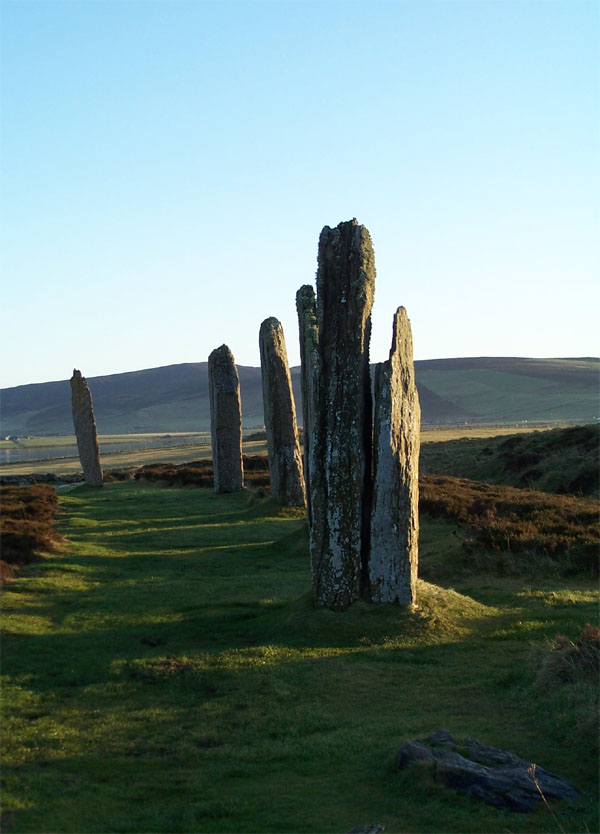
Photo: Original uploader was Otter at nl.wikipedia (Original text : Hopmans) / Wikimedia Commons / CC BY-SA 3.0 Ring of Brodgar / Standing Stones of Stenness / Maeshowe
Nearby Neolithic monuments connected to Skara Brae by a 'low road'; part of the same ceremonial landscape
-
Knap of Howar, Papa Westray
Earlier, similar Neolithic farmstead (c. 3500–3100 BC), thought to be the oldest preserved standing building in northern Europe
-
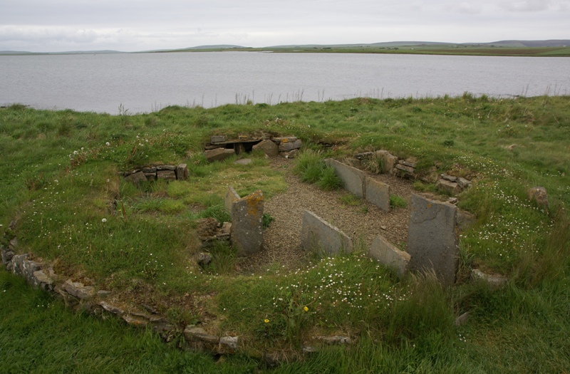
Photo: Otter / Wikimedia Commons / CC BY-SA 3.0 Barnhouse Settlement
Comparable settlement by Loch of Harray (c. 3000 BC) with similar hearths, beds, dressers and drains
-
Skaill House
Adjacent mansion, home of excavator William Watt
Discovery & excavation
In the winter of 1850 a severe storm stripped earth from a knoll at the Bay of Skaill, exposing the stone houses beneath; local villagers found the outline of a roofless village. William Watt of Skaill House began an amateur excavation, uncovering four houses before stopping in 1868. The site was plundered by a party with shovels over a single weekend in 1913, and a 1924 storm swept away part of a house, prompting proper investigation under Professor V. Gordon Childe from 1927. Excavations in 1972–73 settled the site's date and reached waterlogged layers that preserved rare organic finds.
Finds now held at: Stromness Museum (the 'Skara Brae Buddo' whalebone figurine); on-site museum (carved stone balls).
In culture
-
The settlement inspired Kathleen Fidler's 1968 children's novel The Boy with the Bronze Axe, set during its final days, and Rosemary Sutcliff's 1977 novel Shifting Sands.
-
It is referenced in the film Indiana Jones and the Kingdom of the Crystal Skull and in the NCIS episode 'Murder 2.0'; the Irish folk group Skara Brae took its name from the site, and it lends its name to towns in the video games The Bard's Tale and Ultima.
What to look for
-
Ten visible structures and four passageways, with stone furniture surviving in place.
-
The standard house layout: a central hearth, a stone dresser against the wall opposite the low slab-doored entrance, and beds built on either side (a larger bed to the right, a smaller to the left).
-
House 8 — a stand-alone above-ground structure with walls over 2 m thick and a 'porch', lacking dressers and storage boxes; thought to have been a workshop for making tools.
-
Clay-sealed waterproof stone boxes (possibly for keeping limpet bait) and the drains running beneath at least five of the houses.
What is said
Folklore and tradition, recorded as what is said — not as established fact.
-
Euan MacKie proposed that Skara Brae may have been home to a privileged theocratic class of wise men engaged in astronomical and magical ceremonies at the nearby Ring of Brodgar and Standing Stones of Stenness. (doubted by Graham and Anna Ritchie, who note no archaeological evidence supports it)
-
Symbols carved into stone lintels and bed posts have sometimes been said to show 'runic writings', though the translations offered for them remain contested. (interpretations regarded as controversial)
Standing there
- The settlement stands pressed right against the Bay of Skaill: the Atlantic breaks a few metres from the houses, so the dominant sounds are surf, wind across open machair grassland, and seabirds, with salt spray carrying on the breeze that strips this exposed Orkney coast.
- Looking down into the roofless stone rooms, the furniture survives in place — a central hearth, a stone dresser set against the far wall, and box-beds to either side — so the layout of a single low room reads at a glance, all of it grey local flagstone with no timber or thatch remaining.
- When the village was lived in around 3000 BC, the interiors would have been dim, smoky and warm: lit and heated by the central peat or driftwood hearth whose smoke filled the low roofed space, the air thick with the smell of burning fuel, cooking and the cattle, sheep and pigs the people kept.
- The everyday smells then were strongly of the sea and the midden: fish, shellfish and limpets formed much of the diet, and the houses were deliberately set into a mound of domestic refuse and ash that insulated the walls, so decaying food waste and woodsmoke would have hung close about the settlement.
- Moving between the houses then meant stooping through low, narrow slab-roofed passageways that could be sealed with a stone door — a cramped, sheltered, half-buried world moving from one warm hearth-lit room to the next out of the constant coastal wind.
Plan your visit
- Location
- 59.0487°N · 3.3418°W
- Nearest settlement
- Stromness
- Access
- Paid entry — managed visitor site
- Terrain
- Moderate walking
- Start point
- Sandwick · Orkney · KW16 3LR · National Grid reference: HY 231 188 · There are no spaces for large campervans in the car park, but please phone the site in advance to check if there is space in the beach car park.
- Start point
- Skara Brae visitor centre car park — Official HES car park at the visitor centre. No spaces for large campervans; phone ahead for the beach car park.
- Sat-nav
- KW16 3LR
Opening & admission
Free entry
Nearby places
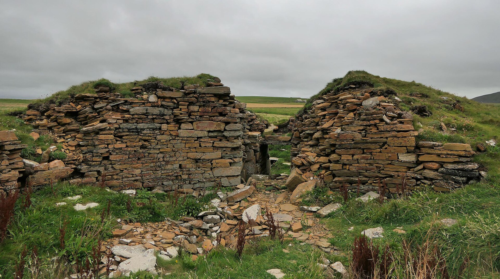
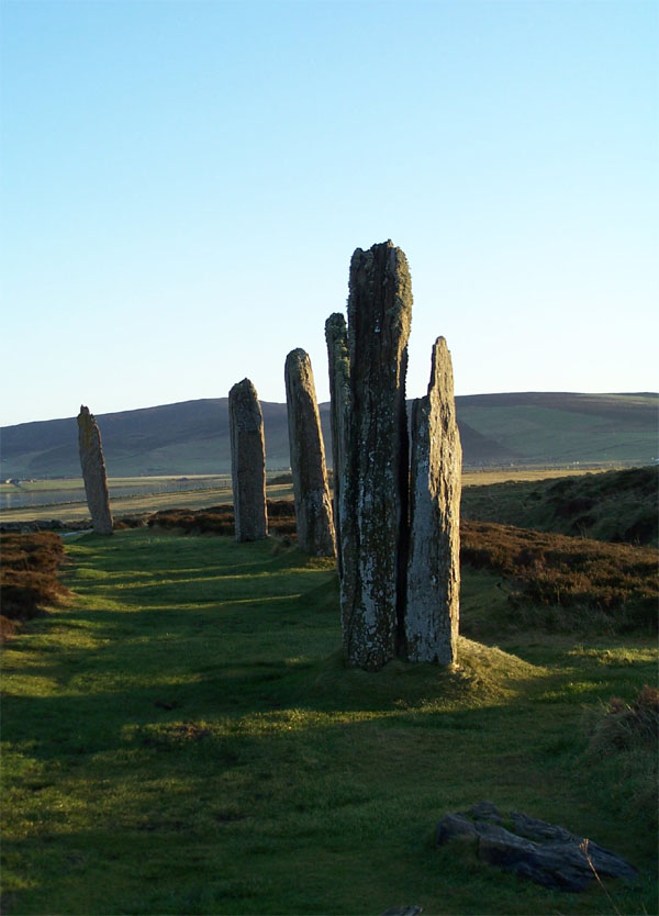
Carved stone · Prehistoric
Ring of Brodgar
Orkney Islands
The Ring of Brodgar is a Neolithic henge and stone circle on the narrow isthmus between the Lochs of Stenness and Harray on Mainland, Orkney. It is…
- Near Stenness
- 5 min walk from car park
- Easy path
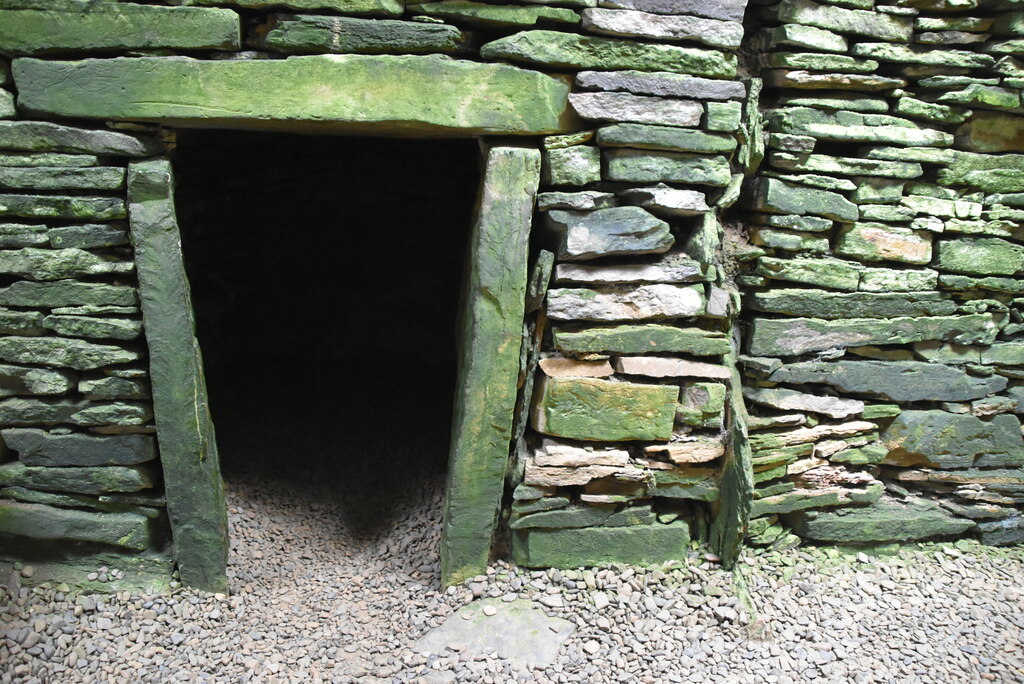
Tomb or burial place · Prehistoric
Unstan Chambered Cairn
Orkney Islands
The chambered cairn was built sometime between about 3400 and 2800 BC (on the evidence of nearby tombs) as a Neolithic burial monument on a promont…
- Near Stenness
- 2 min walk from car park
- Easy path
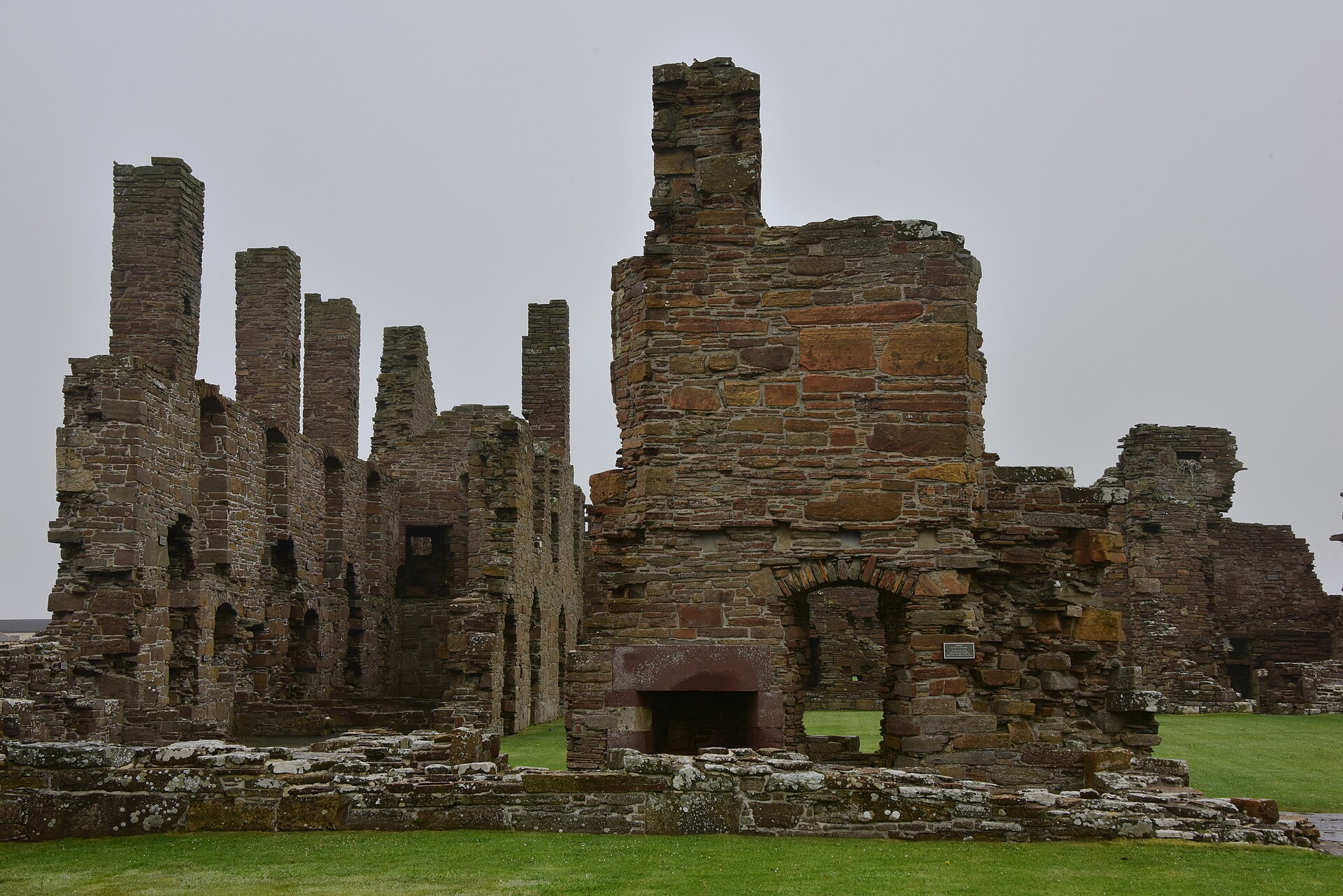
Fortified place · Medieval
Earl's Palace, Birsay
Orkney Islands
It is the ruined seat of Robert Stewart, 1st Earl of Orkney, an illegitimate son of James V, and a rare surviving example of a fortified sixteenth-…
Questions people ask
- Who built Skara Brae?
- A Neolithic farming community, sometimes called the Grooved Ware people, who kept cattle, pigs and sheep and grew barley; their own name for the settlement is not recorded.
- How old is Skara Brae?
- Radiocarbon dating places occupation from about 3180 BC to around 2500 BC — roughly six hundred years, and older than Stonehenge or the Great Pyramid.
- Can you visit Skara Brae?
- Yes — it is a Historic Environment Scotland site near Sandwick, Orkney, with a visitor centre car park about 395 metres from the houses. Check current opening times before travelling.
- Where is Skara Brae?
- On the Bay of Skaill, on the west coast of Mainland, Orkney, at Sandwick, KW16 3LR (National Grid reference HY 231 188).
- What survives at Skara Brae?
- Ten roofless stone houses and four connecting passageways, with stone furniture — hearths, dressers, box-beds — still in place inside most of them.
Sources
- Canmore site record 1663 (accessed 2026-06-13)
- Wikipedia: Skara Brae (accessed 2026-06-13)
- Wikidata Q816437 (accessed 2026-06-13)
- HES prices/opening (accessed 2026-07-09)
- HES getting-here (accessed 2026-07-09)
Explore more: Settlements · Prehistoric · Orkney Islands
The Ancient Codex, in your pocket
Get the Pocket Codex app
Carry the directory with you — Skara Brae and thousands of ancient places across Britain and Ireland, offline, wherever you roam.