
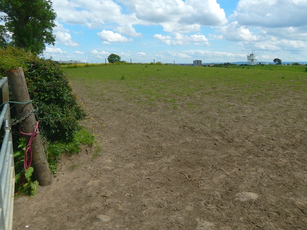
A beech-ringed plantation and wide views mark Castlehill’s place on the Roman frontier. Castlehill Fort was a Roman fort (a military base) on the Antonine Wall, with little obvious masonry now visible but important distance slabs recorded from the area.
The site matters because its landscape setting and inscriptions preserve different kinds of evidence. The view helps explain Roman line-of-sight planning, while the slabs record legions measuring and commemorating their work on the Wall.
What follows is drawn from published sources, with each claim labelled by how firmly it is established.
History
Castlehill stood on the Antonine Wall between Bearsden and Duntocher, with Cleddans and Hutcheson Hill nearby.
Two Roman distance slabs were found at or near the site, one in 1803 and another in 1826.
A Roman altar was also found in 1826.
The Sixth Legion slab records a length of wall work, though the exact interpretation of the units remains a matter of research.
People
-
Sir George Macdonald
Described the slabs and commented on the lettering and workmanship.
-
Sixth Legion
Named on one of the Castlehill distance slabs.
Cultural influences
-
Distance slabs
The slabs are formal Roman inscriptions celebrating completed construction work.
-
Frontier visibility
The summit panorama helps explain why the site was useful in a chain of Wall forts and fortlets.
Connections
-
Summerston
One Castlehill slab is compared with a similar slab found near Summerston.
-
Duntocher
Neighbouring fort west of Castlehill.
-
Hunterian Museum
The source pack cites Hunterian records for distance slabs and an altar.
Discovery & excavation
Distance slabs were found in 1803 and 1826, and an altar was discovered in the same year as the second slab. Decorative pelta shields and rosettes are noted on the inscriptions.
What to look for
-
Beech plantation
A circular enclosed plantation is the main visible landmark now.
-
Panorama
The summit overlooks many findspots and frontier positions.
-
Signage
The pack notes that signage helps where the Wall line is hard to see.
Plan your visit
- Location
- 55.9245°N · 4.3633°W
- Access
- Open access
- Terrain
- Moderate walking
Opening & admission
The pack gives no formal admission details; visitors should use current local access information and on-site signage.
- A circular plantation of beech trees is the main visible feature.
- The summit provides wide views.
Nearby places
Fortified place · Roman
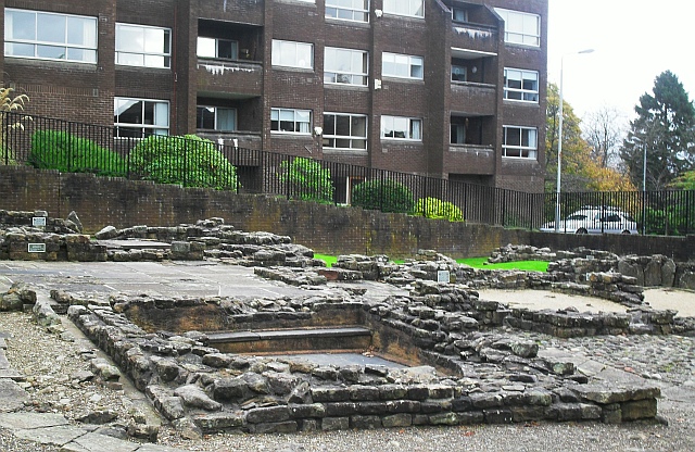
Bearsden Roman Bath House
East Dunbartonshire
The Romans built a stone-and-turf fortification, the Antonine Wall, between the Firth of Clyde and the Firth of Forth between AD 142 and 144 under…
- Near Bearsden
- 3 min walk from car park
Questions people ask
- What can visitors see at Castlehill Fort?
- The pack says a circular enclosed plantation of beech trees is about all that is visible now, with some signage for the Wall line.
- What important finds came from Castlehill?
- Two Roman distance slabs and a Roman altar are recorded from the site or nearby.
- What is a distance slab?
- It is an inscribed Roman stone recording construction work, often naming the military unit responsible.
- Which legion appears at Castlehill?
- One slab records work by the Sixth Legion.
- Where is Castlehill on the Wall?
- It lies west of Bearsden and east of Duntocher, with Cleddans and Hutcheson Hill between neighbouring forts.
Sources
Explore more: Fortified places · Roman · East Dunbartonshire
The Ancient Codex, in your pocket
Get the Pocket Codex app
Carry the directory with you — Castlehill Fort and thousands of ancient places across Britain and Ireland, offline, wherever you roam.