
Modern streets and canal-side ground define the Cadder source pack rather than a visible fort. The current evidence bundle identifies Cadder as a Glasgow neighbourhood, so this page treats it cautiously as a fortified-place candidate with weak site-specific heritage evidence.
The source text places Cadder on the Forth and Clyde Canal route, close to cemeteries, Possil Marsh and neighbouring districts. It also warns readers not to confuse this Cadder with the separate Cadder near Bishopbriggs, which is important context for avoiding a false heritage match.
What follows is drawn from published sources, with each claim labelled by how firmly it is established.
History
The neighbourhood was built in the late 1940s and early 1950s on the site of a loch.
Cadder sits on the route of the Forth and Clyde Canal, with Glasgow Western Necropolis, Lambhill Cemetery and St Kentigern's Cemetery nearby.
The source pack explicitly distinguishes this Cadder from Cadder near Bishopbriggs, several miles to the north-east along the canal.
Gilshochill railway station opened under the name Lambhill in 1993 and was renamed in 1998.
People
-
Jeff Holmes
Published a 2022 book on growing up in the scheme, using stories and photographs contributed by residents.
Cultural influences
-
Place-name caution
The pack's warning about two Cadders makes identity control the main heritage issue for this page.
-
Canal setting
The Forth and Clyde Canal gives the modern neighbourhood its clearest landscape connection.
Connections
-
Forth and Clyde Canal
Runs through or beside the Cadder context described in the source.
-
Cadder near Bishopbriggs
A separate place that the source says should not be confused with this one.
-
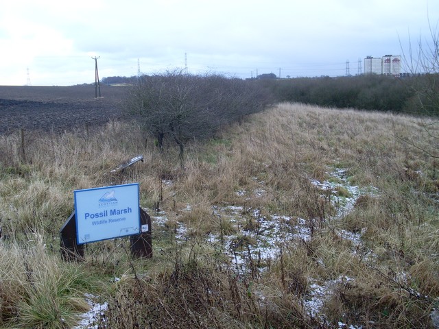
Photo: Stephen Sweeney / Wikimedia Commons / CC BY-SA 2.0 Possil Marsh
Borders the neighbourhood on its eastern side.
Discovery & excavation
The provided pack contains no excavation or fort-discovery evidence for this Cadder entry. It supports local neighbourhood context rather than a confirmed fortified monument.
In culture
-
Community memoir
A 2022 book gathered memories and photographs from local residents.
What to look for
-
Canal route
The canal is the strongest landscape feature named in the source pack.
-
Neighbourhood slope
The pack describes a compact neighbourhood on a fairly steep incline.
-
Identity warning
Use care not to conflate this Cadder with the separate Cadder near Bishopbriggs.
Plan your visit
- Location
- General area near East Dunbartonshire, East Dunbartonshire
- Terrain
- Easy going
Opening & admission
The current pack describes a modern neighbourhood rather than a confirmed visitor monument; check local context before travelling.
- Do not confuse this Cadder with Cadder near Bishopbriggs.
- The page is cautious because the source pack does not confirm a fort.
This is a sensitive or fragile site, so we show only its general area. Please check official heritage sources for access before visiting, and take care not to disturb it.
Nearby places
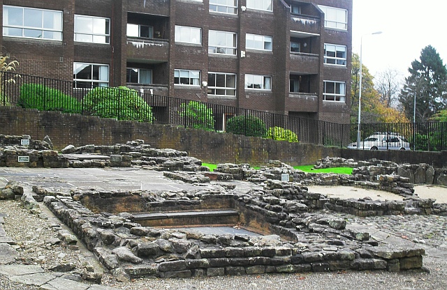
Fortified place · Roman
Bearsden Roman Bath House
East Dunbartonshire
The Romans built a stone-and-turf fortification, the Antonine Wall, between the Firth of Clyde and the Firth of Forth between AD 142 and 144 under…
- Near Bearsden
- 3 min walk from car park
Questions people ask
- Is this Cadder a confirmed fort?
- The supplied source pack does not confirm a fort. It describes a modern Glasgow neighbourhood and warns against confusing it with another Cadder.
- Where is this Cadder?
- The pack places it in the north of Glasgow within the Canal ward, on the route of the Forth and Clyde Canal.
- What should readers not confuse it with?
- It should not be confused with Cadder near Bishopbriggs, about three miles to the north-east along the canal.
- What heritage context is named nearby?
- Nearby named places include Glasgow Western Necropolis, Lambhill Cemetery, St Kentigern's Cemetery and Possil Marsh.
- Why is the page cautious?
- Because the batch type says fortified place, but the current source pack and binding describe a suburb rather than a protected fort site.
Sources
Explore more: Fortified places · Medieval · East Dunbartonshire
The Ancient Codex, in your pocket
Get the Pocket Codex app
Carry the directory with you — Cadder and thousands of ancient places across Britain and Ireland, offline, wherever you roam.