
Its rare triangular moated plan, unique among British castles, encloses four centuries of Maxwell power and border warfare, from Edward I's siege of 1300 to the Covenanter slighting of 1640.
A moated stronghold on the Solway shore, Caerlaverock Castle takes a triangular plan unlike that of any other castle in Britain, some eleven kilometres south of Dumfries at the edge of the Caerlaverock National Nature Reserve. First built in the thirteenth century and said to have been sited to control trade, it was a stronghold of the Maxwell family from the 1200s until the 1600s. It was besieged by the English during the Wars of Scottish Independence and underwent several partial demolitions and reconstructions across the fourteenth and fifteenth centuries. In the seventeenth century the Maxwells, created Earls of Nithsdale, added a new lodging within the walls, counted among the most ambitious early classical domestic architecture in Scotland. Besieged for the last time by a Covenanter army in 1640, it was then abandoned. Historic Environment Scotland now cares for the scheduled monument.
What follows is drawn from published sources, with each claim labelled by how firmly it is established.
The name
The name Caerlaverock is of Brittonic origin. The first element, cajr (Welsh caer, 'fort, city'), means an enclosed, defensible site; the second may be a personal name or a lost stream-name from the adjective laβar, 'talkative'. The present form has been influenced by the Scots word laverock, 'skylark'.
History
Around 1220, Alexander II of Scotland granted the lands to Sir John Maxwell, who began the first castle at Caerlaverock — a square structure and one of the earliest stone castles in Scotland.
In the 1270s Sir Aymer Maxwell completed the present triangular castle on a rock outcrop some 200 metres north of the abandoned first castle.
In July 1300, Edward I of England besieged Caerlaverock; the Maxwell garrison of only sixty men, under Sir Eustace Maxwell, withstood the English army for a considerable period before surrendering.
Around 1355 Sir Roger Kirkpatrick of Closeburn captured the castle for David II of Scotland and partly dismantled it.
In 1570 an English Protestant force led by the Earl of Sussex besieged and partly demolished the castle, destroying the gatehouse with gunpowder.
In 1640 a Protestant Covenanter army besieged Caerlaverock for thirteen weeks, forcing its surrender; the south wall and tower were demolished and the castle was never repaired or reoccupied.
People
-
Sir John Maxwell
First Lord Maxwell of Caerlaverock and Warden of the West March; began work on the first castle around 1220
-
Sir Aymer Maxwell
Brother of Sir John; built the present triangular castle, completed in the 1270s
-
Sir Eustace Maxwell
Maxwell chief who led the defence during Edward I's siege of 1300 and later dismantled the fortress for Robert Bruce
-
Robert, 10th Lord Maxwell
Made Earl of Nithsdale after 1619; built the south and east ranges known as the Nithsdale Lodging
-
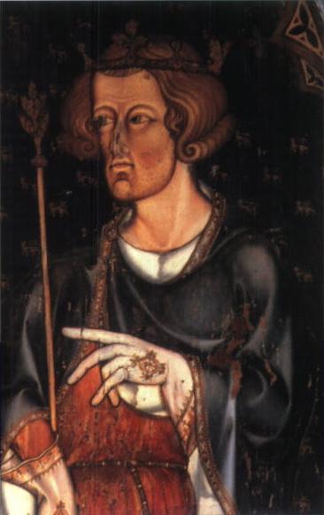
Portrait: Remiguis Goebel / Wikimedia Commons / Public domain Edward I of England
Led the English army that besieged Caerlaverock in 1300
Connections
-
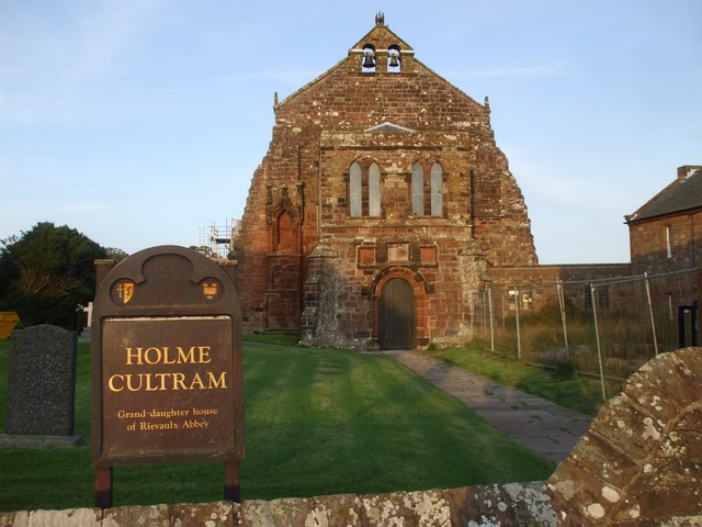
Photo: John Lord / Wikimedia Commons / CC BY-SA 2.0 Holm Cultram Abbey
The lands of Caerlaverock were granted to its monks around 1160, the earliest mention of the estate
-
Lochmaben Castle
Attacked in 1299 by the Caerlaverock garrison while it was held by English forces
-
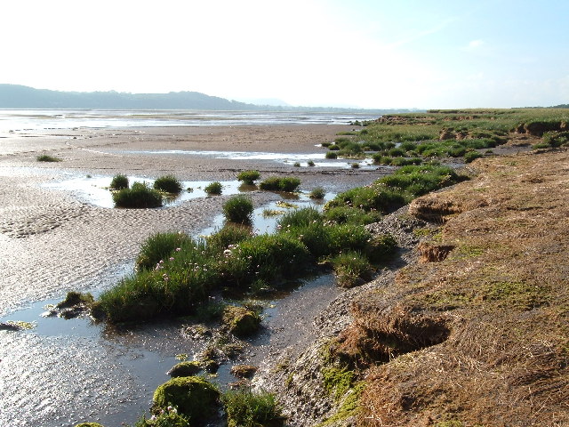
Photo: Alison Stamp / Wikimedia Commons / CC BY-SA 2.0 Caerlaverock National Nature Reserve
The castle stands at the northern edge of this 55-square-kilometre reserve of saltmarsh and mudflats, an internationally important wintering site for waterfowl
In culture
-
During the 1300 siege, English heralds composed a roll of arms in Old French verse, known as the Siege of Caerlaverock, naming each noble and knight present and describing his armorial bearings.
-
The castle was used as a filming location for the 2011 romantic comedy The Decoy Bride.
What to look for
-
The triangular plan enclosed by a moat and earthwork ramparts, one of only a few in Europe and the only such castle in the UK
-
The twin-towered gatehouse at the northern apex, its ashlar drum towers standing some 15.5 metres to the late-fifteenth-century machicolations
-
Murdoch's Tower at the south-west corner, largely complete, contrasting with the south-east tower reduced to base level in the 1640 siege
-
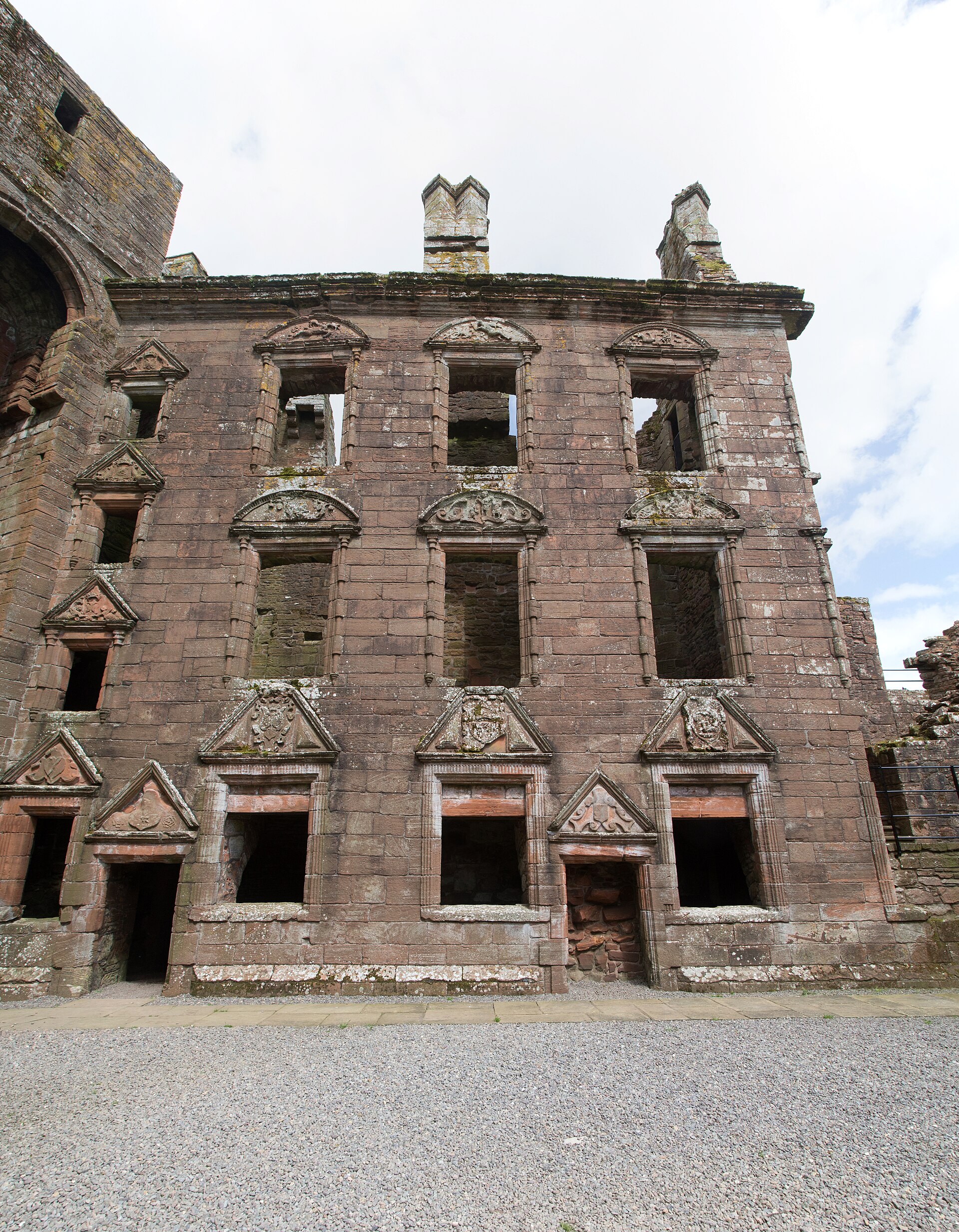
The Nithsdale Lodging's Renaissance façade of the 1630s, decorated with carved pediments over its windows bearing armorials and symbolic sculptures
-
The red sandstone of the earliest parts, quarried nearby at Bankend
What is said
Folklore and tradition, recorded as what is said — not as established fact.
-
King Gwenddoleu ap Ceidio died near Caerlaverock at the Battle of Arthuret in 573, and his death drove his bard Myrddin Wyllt to madness and into the woods — an act later said to have inspired the character of Merlin in Arthurian legend.
Plan your visit
- Location
- General area near Dumfries and Galloway, Dumfries and Galloway
- Access
- Paid entry — managed visitor site
- Terrain
- Easy going
- Time needed
- About 90 minutes
- Facilities
- Car park, visitor centre and toilets on site.
Opening & admission
Ticketed entry, in the care of Historic Environment Scotland. Seasonal opening — check current times before visiting.
- Level grassy approach to the moat; steps and uneven ground within the ruin.
This is a sensitive site, so we show its general area only. Please use the official access information here rather than seeking out an independent route.
Nearby places
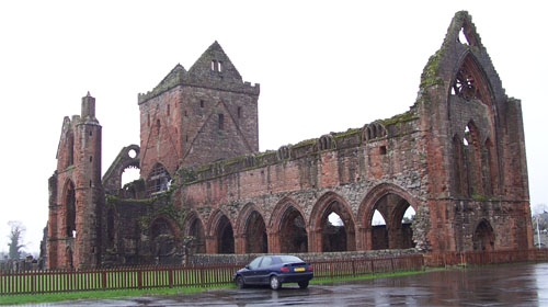
Building or ruin · Medieval
Sweetheart Abbey
Dumfries and Galloway
It is one of Scotland's most evocative Cistercian ruins, founded and named for a widow's lifelong devotion to her husband's embalmed heart.
- Easy path
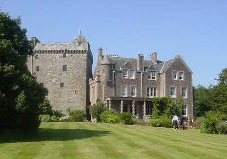
Fortified place · Medieval
Comlongon Castle
Dumfries and Galloway
An exceptionally complete red sandstone tower house that preserves the Royal Arms of Scotland above its hearth and a dozen chambers built into the…
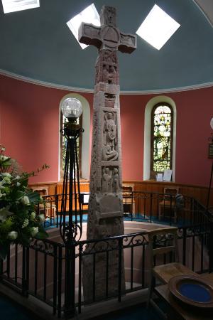
Carved stone · Pictish & early medieval
Ruthwell Cross
Dumfries and Galloway
The Ruthwell Cross is a stone Anglo-Saxon cross probably dating from the 8th century, when Ruthwell — now in Scotland — was part of the Anglo-Saxon…
- Near Ruthwell
- 1 min walk from car park
- Easy path
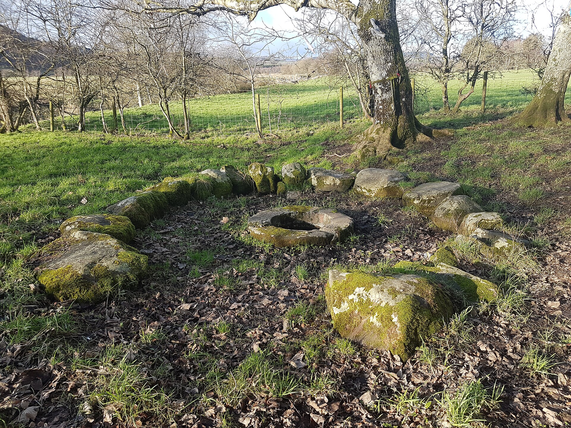
Sacred place · Medieval
St Queran's Well
Dumfries and Galloway
It is a rare example of a Scottish holy well where votive offerings, recovered coins dating back to 1560 and ribbons tied to bushes, show an unbrok…
Questions people ask
- Why is Caerlaverock Castle triangular?
- The castle was laid out on a triangular plan in the last quarter of the thirteenth century, with a twin-towered gatehouse at the northern apex and drum towers at the two southern corners. It is the only triangular castle in the UK.
- Who besieged Caerlaverock in 1300?
- Edward I of England besieged it in July 1300 with a large army including many English barons. Sir Eustace Maxwell's garrison of only sixty men held out for a considerable period before surrendering.
- Who owned Caerlaverock Castle?
- It was a stronghold of the Maxwell family from the thirteenth century until the seventeenth, when the Maxwells were created Earls of Nithsdale. It is now cared for by Historic Environment Scotland.
- Why was the castle abandoned?
- In 1640 a Covenanter army besieged Caerlaverock for thirteen weeks and forced its surrender. The south wall and tower were then demolished, and the castle was never repaired or reoccupied.
- What is the Nithsdale Lodging?
- An elaborate range of south and east buildings added within the walls after 1619 by Robert, 1st Earl of Nithsdale. Its 1630s Renaissance façade is described as among the most ambitious early classical domestic architecture in Scotland.
Sources
- Canmore: Caerlaverock Castle, site record 66100 (accessed 2026-07-18)
- Historic Environment Scotland: designation LB3799 (accessed 2026-07-18)
- Wikipedia: Caerlaverock Castle (accessed 2026-07-18)
Explore more: Fortified places · Medieval · Dumfries and Galloway
The Ancient Codex, in your pocket
Get the Pocket Codex app
Carry the directory with you — Caerlaverock Castle and thousands of ancient places across Britain and Ireland, offline, wherever you roam.