
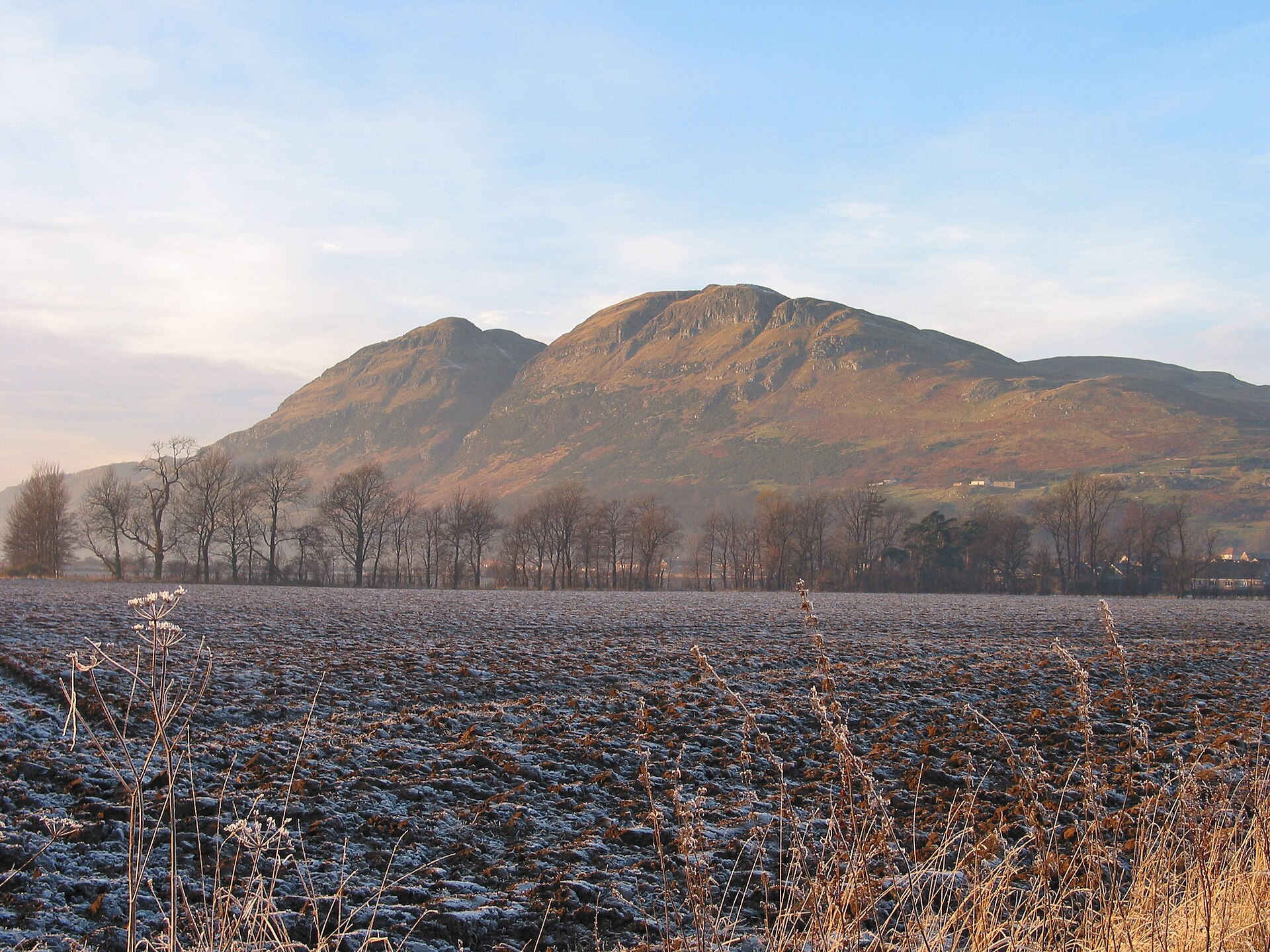
Dumyat rises at the western end of the Ochil Hills, small in height at 418 metres but unmistakable in the Stirling skyline. The ancient fort is on Castle Law, the western summit, where the remains of a hillfort originally occupied by the Maeatae are still clearly discernible.
The hill is part archaeology, part landmark and part climb. Its name is thought to mean the hill fort of the Maeatae, while radiocarbon dates from excavations point to use around 500 BC and again in the 5th to 7th centuries AD, giving the summit a long life before its modern cairn, memorials and Jubilee beacon.
What follows is drawn from published sources, with each claim labelled by how firmly it is established.
The name
The name Dumyat, or Dunmyat, is thought to come from Dùn Mhèad, interpreted in the pack as the hill fort of the Maeatae.
History
Around 500 BC, radiocarbon evidence indicates one period of use at the Castle Law hillfort. The remains on the western summit are still clearly discernible, preserving the fortified character behind the hill's name.
The fort was later occupied again in the 5th to 7th centuries AD, according to radiocarbon dates from excavations. That second phase places Dumyat within the early medieval landscape as well as the Iron Age one.
The site is associated with the Maeatae, a people remembered in the suggested origin of the hill's name. Their link to the summit gives the hillfort its strongest historical identity in the pack.
The fort has been excavated by Dr Murray Cook and Professor Gordon Noble of Aberdeen University. Their work supplied the radiocarbon dates that show at least two periods of use.
In later centuries the hill also carried practical and industrial uses. The exposed surrounding muir was suited only to sheep farming, with sheep folds and the ruins of a shepherd's stone house on the slopes, while small-scale copper and barytes mining once took place before being abandoned.
In 1977 the beacon on top of Dumyat was commissioned for the Queen's Silver Jubilee. It was carried up and erected by the Menstrie Scout Group as part of the UK chain of beacons lit for the celebrations.
People
-
Maeatae
The Maeatae are associated with the original occupation of the Castle Law hillfort and with the suggested meaning of Dumyat's name.
-
Dr Murray Cook
Dr Murray Cook excavated the fort, contributing to the radiocarbon dating evidence.
-
Professor Gordon Noble
Professor Gordon Noble of Aberdeen University excavated the fort with Dr Murray Cook.
-
Menstrie Scout Group
The Menstrie Scout Group carried up and erected the 1977 Silver Jubilee beacon.
Cultural influences
-
Ochil geology
The hill's gullies and scarp face reflect fault erosion, with soft pyroclastic rocks set against harder andesite and basalt.
Connections
-
Ochil Hills
Dumyat stands at the western extremity of the Ochil Hills.
-
Castle Law
The hillfort remains lie on Castle Law, Dumyat's western summit.
-
Abbey Craig
Dumyat is often depicted with nearby Abbey Craig in views of the Stirling area.
-
Wallace Monument
The hill's popularity with visitors is linked in the pack to the nearby Wallace Monument and the historic Stirling area.
-
Sheriffmuir
Many walkers now park on Sheriffmuir and take a longer, gentler path towards the summit.
-
Menstrie Glen
A route from Menstrie Glen gives a gentler start before steepening near the summit.
In culture
-
Stirling landscape image
Dumyat's characteristic shape is often depicted in postcards and calendars, especially with nearby Abbey Craig.
-
Silver Jubilee beacon
The summit beacon was part of the UK chain of beacons lit for the Queen's Silver Jubilee in 1977.
What to look for
-
Castle Law hillfort
The remains of the ancient hillfort are still clearly discernible on Castle Law, the western summit.
-
Two summits
Dumyat has two principal summits: Castle Law to the west and Dumyat proper to the east.
-
Summit cairn and beacon
The top has a characteristic cairn with a beacon, currently filled with stones.
-
Memorials and trig point
The summit includes an Argyll and Sutherland Highlanders memorial, a memorial bench to Mr Michael Simpson and a trig point.
-
Scarp gullies
The southern scarp face has several gullies formed by fault erosion; Raeburn's Gulley is described as particularly dangerous.
What is said
Folklore and tradition, recorded as what is said — not as established fact.
-
Wishes in the beacon
A local custom says the stones placed in the summit beacon are wishes made by others.
Plan your visit
- Location
- 56.1577°N · 3.8773°W
- Access
- Reached on a public path
- Terrain
- Rough ground — reasonable boots advised
Opening & admission
The pack does not mention admission; check local information before setting out.
- Dumyat is a popular climb, with many people using the longer gentler path from Sheriffmuir.
- The exposed terrain and surrounding muir are described as suitable only for sheep farming.
- Raeburn's Gulley is particularly dangerous and should only be attempted by experienced, properly equipped rock climbers.
Nearby places
Fortified place · Iron Age
Castle Law, Dumyat
Stirling
Dumyat is a hill (418 metres) at the western extremity of the Ochil Hills in central Scotland, with two principal summits: Castle Law on the west a…
- Near Blairlogie
- 947 metres from car park
- Some walking
Fortified place · Medieval
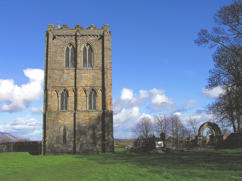
Cambuskenneth Abbey
Stirling
Cambuskenneth Abbey, a provostry of canons regular on land enclosed by a meander of the River Forth near Stirling, was founded by order of King Dav…
- Near Stirling
- 263 metres from car park
Fortified place · Medieval
Stirling Castle
Stirling
Stirling Castle holds the finest surviving Renaissance royal architecture in the British Isles, raised by the Stewart kings on a crag that commande…
Questions people ask
- Where is the Dumyat hillfort?
- The hillfort remains are on Castle Law, the western summit of Dumyat at the western end of the Ochil Hills.
- How old is the Dumyat fort?
- Radiocarbon dates from the site indicate at least two periods of use: around 500 BC and in the 5th to 7th centuries AD.
- Who occupied the hillfort?
- The pack says the fort was originally occupied by the Maeatae, whose name is also linked to the suggested origin of Dumyat's name.
- Is Dumyat a difficult climb?
- The pack describes several routes, including a longer gentler path from Sheriffmuir, but also exposed terrain, steep gullies and Raeburn's Gulley, which should only be attempted by experienced and properly equipped rock climbers.
- What is on the top of Dumyat?
- The summit has memorials, a trig point, a cairn and a beacon commissioned for the Queen's Silver Jubilee in 1977.
Sources
- Wikipedia article
- Wikidata
- Information about the hill fort
- British Geological Survey aerial photo
Explore more: Fortified places · Iron Age · Clackmannanshire
The Ancient Codex, in your pocket
Get the Pocket Codex app
Carry the directory with you — Dumyat and thousands of ancient places across Britain and Ireland, offline, wherever you roam.