
Bothwellhaugh Roman Fort lies within Strathclyde Country Park, east of the South Calder Water where it enters Strathclyde Loch. The setting has changed dramatically: before Bothwellhaugh village was flooded to form the loch, the fort overlooked the point where the Roman road crossed the South Calder Water near its meeting with the River Clyde.
The site is a scheduled monument, but its story is wider than the fort alone. A Roman bath house, found beneath a pond in 1973 and later moved to higher ground, has helped make Bothwellhaugh one of the clearer windows onto Roman military life around the Clyde and the Antonine frontier.
What follows is drawn from published sources, with each claim labelled by how firmly it is established.
History
In the Roman period, Bothwellhaugh stood above a strategic crossing point where the road known as Watling Street bridged the South Calder Water near its confluence with the River Clyde. Old maps show the Roman road before the Clyde was diverted and before the fort was rediscovered.
The fort was built in a scalene right quadrilateral pattern and was large enough to house both troops and cavalry. Its road links probably connected it to sites on the Antonine Wall and southwards to Castledykes, although the exact routes remain a matter of ongoing study.
A Roman structure at Bothwellhaugh was mentioned in the Dalziel section of the Old Statistical Account, preserving a clue to the site's identity before modern archaeological rediscovery.
In 1925 J. M. Davidson rediscovered the fort. That rediscovery restored Bothwellhaugh to the Roman map of central Scotland and linked the site again with the wider military landscape around Motherwell, Hamilton and Bellshill.
In November 1973, a Roman bath house was found beneath a pond between the fort and the medieval bridge anachronistically named Roman Bridge. Lawrence Keppie directed the complete excavation in 1975-76, revealing a suite of rooms: vestibule, frigidarium, two tepidaria, caldarium and praefurnium.
In 1980 the bath house was moved to higher ground and is now open to the public. Its scale suggests that perhaps around 20 soldiers could use it at one time, while the distance between the baths and fort hints that other structures may still lie undiscovered.
The excavations produced hundreds of artefacts, including a Roman drain cover slab, a hunt cup and a tile with a paw print. Pottery from the site established an Antonine occupation, but exactly how Bothwellhaugh related to the Antonine Wall is still unclear.
People
-
J. M. Davidson
J. M. Davidson rediscovered Bothwellhaugh Roman Fort in 1925.
-
Lawrence Keppie
Lawrence Keppie directed the complete excavation of the bath house in 1975-76.
Cultural influences
-
Antonine military landscape
Pottery establishes Antonine occupation, and the fort was likely connected by roads to the Antonine Wall and to Castledykes.
Connections
-
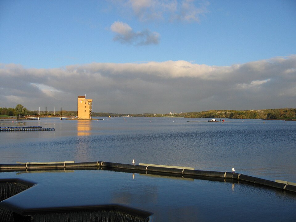
Photo: No machine-readable author provided. Supergolden assumed (based on cop / Wikimedia Commons / CC BY-SA 3.0 Strathclyde Country Park
The fort site now lies within Strathclyde Country Park.
-
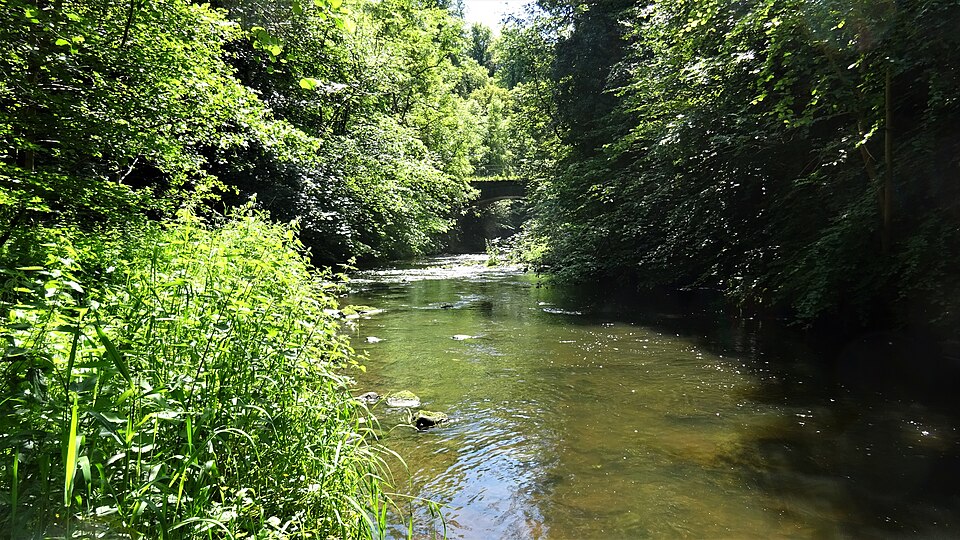
Photo: Rosser1954 / Wikimedia Commons / CC BY-SA 4.0 South Calder Water
The fort overlooked the Roman road crossing near the South Calder Water's confluence with the River Clyde.
-
Antonine Wall
Bothwellhaugh was probably linked by roads to sites on the Antonine Wall, though the exact connections remain under study.
-
Castledykes
The fort was probably also linked southwards to Castledykes.
-
Hunterian Museum, Glasgow University
Hundreds of artefacts from excavations at the site were taken to the Hunterian Museum.
Discovery & excavation
The Old Statistical Account mentioned a Roman structure in the Dalziel section, and J. M. Davidson rediscovered the fort in 1925. A Roman bath house was found in November 1973 beneath a pond and was fully excavated in 1975-76 under Lawrence Keppie.
Finds now held at: fort site; bath house beneath a pond; Hunterian Museum, Glasgow University.
What to look for
-
Fort setting
The fort lies within Strathclyde Country Park, east of where the South Calder Water flows into Strathclyde Loch.
-
Bath house
The relocated Roman bath house preserves the sequence of vestibule, cold room, warm rooms, hot room and furnace room.
-
Roman Bridge context
The bath house was found between the fort and the medieval bridge anachronistically named Roman Bridge.
-
Artefact story
Finds included a drain cover slab, a hunt cup, a tile with a paw print and pottery establishing Antonine occupation.
Plan your visit
- Location
- 55.7940°N · 4.0270°W
- Access
- Open access
- Terrain
- Moderate walking
Opening & admission
The pack says the relocated bath house is open to the public; check the official site for current access arrangements.
- The site is now within Strathclyde Country Park.
- The Roman bath house was moved to higher ground in 1980 and is now open to the public.
- The fort's wider relationship to the Antonine Wall remains under study.
Nearby places
Fortified place · Medieval
Bothwell Castle
South Lanarkshire
Bothwell was among the most ambitious stone castles of thirteenth-century Scotland, and its ruins record a century of siege, slighting and rebuildi…
Sacred place · Medieval
Glasgow Cathedral
Glasgow City
It is the oldest cathedral on the Scottish mainland and one of only two medieval Scottish cathedrals to survive the Reformation virtually intact.
Questions people ask
- Where is Bothwellhaugh Roman Fort?
- The fort site is now within Strathclyde Country Park in North Lanarkshire, east of where the South Calder Water flows into Strathclyde Loch.
- What kind of Roman site was Bothwellhaugh?
- It was a Roman fort built in a scalene right quadrilateral pattern and large enough to house both troops and cavalry.
- When was the fort rediscovered?
- The fort was rediscovered by J. M. Davidson in 1925, after an earlier mention of a Roman structure in the Dalziel section of the Old Statistical Account.
- What happened to the Roman bath house?
- The bath house was found beneath a pond in November 1973, fully excavated in 1975-76 under Lawrence Keppie, moved to higher ground in 1980 and is now open to the public.
- Where are the finds from Bothwellhaugh?
- Hundreds of artefacts from the site, including a drain cover slab, a hunt cup and a paw-print tile, were taken to the Hunterian Museum at Glasgow University.
Sources
- Wikipedia article
- Wikidata
- Heritage register
- Media related to Bothwellhaugh Roman Fort at Wikimedia Commons
Explore more: Fortified places · Roman · North Lanarkshire
The Ancient Codex, in your pocket
Get the Pocket Codex app
Carry the directory with you — Bothwellhaugh Roman Fort and thousands of ancient places across Britain and Ireland, offline, wherever you roam.